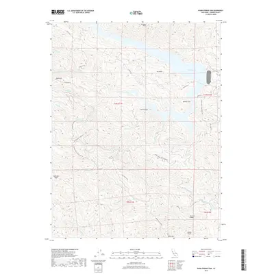
2018 Map of Warm Springs Dam
USGS Topo · Published 2018About this map
Warm Springs Dam serves as the focal point of this northern Sonoma County landscape, holding back the waters of Lake Sonoma. The area is defined by a complex network of canyons and high ridges, including Walbridge Ridge to the west and the prominent Pritchett Peaks to the north. These landforms create a rugged topography where numerous tributaries like Rancheria Cr and Warm Springs Creek feed into the reservoir. Historical access is marked by long-established routes such as Stewarts Point Skaggs Springs Rd and Rockpile Rd, which trace the high ground above the water. Named landmarks like Eagle Rock and Bummer Peak provide fixed points for navigation in this wilderness. The map reveals the rural land use of the era, from the sprawling Warm Springs Ranch to the dense Redwood Canyon, illustrating the transition from ranching heritage to water resource management.
Find a feature on this map
49 named features on this map. Tap any name to fly to it.
Don’t see what you’re looking for? This feature index may not catch every label — zoom into the map to look around manually.
Map Details
Editions of this 2018 Warm Springs Dam Map
This is the sole edition of this map. No revisions or reprints were ever made.
Other maps of this area

1920 · Healdsburg
USGS Topo · 1:62,500

1921 · Skaggs
USGS Topo · 1:62,500

1921 · Kelseyville
USGS Topo · 1:62,500

1933 · Healdsburg
USGS Topo · 1:48,000

1938 · Hopland
USGS Topo · 1:62,500

1940 · Healdsburg
USGS Topo · 1:62,500

1943 · Tombs Creek
USGS Topo · 1:24,000

1943 · Cazadero
USGS Topo · 1:24,000

1943 · Skaggs Springs
USGS Topo · 1:24,000

1943 · Fort Ross
USGS Topo · 1:24,000