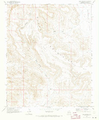
1970 Map of Warm Springs
USGS Topo · Published 1973About this map
The Black Mountains dominate this Mohave County landscape, where the terrain transitions from the high elevations of Black Mesa down toward the Sacramento Valley. This 1970 survey captures a region defined by its water sources and mining history, with Warm Springs and its associated Warm Springs Canyon providing a central drainage path through the mountain range. Smaller water points like Antelope Spring and Alkali Spring are crucial markers in this arid environment, often serving as the primary landmarks for navigation along the network of Jeep Trails. Evidence of 20th-century mineral exploration is visible at the Tipperary Mine and various Prospects situated along the valley's edge. The map traces the natural flow of the land from the volcanic heights of the mesa to the broad alluvial floor of the valley via Warm Springs Wash.
Find a feature on this map
11 named features on this map. Tap any name to fly to it.
Don’t see what you’re looking for? This feature index may not catch every label — zoom into the map to look around manually.
Map Details
Editions of this 1970 Warm Springs Map
2 editions found
Other maps of this area

1886 · Camp Mohave
USGS Topo · 1:250,000

1892 · Camp Mohave
USGS Topo · 1:250,000

1903 · Needles
USGS Topo · 1:125,000

1904 · Needles Special
USGS Topo · 1:125,000

1927 · Yucca
USGS Topo · 1:62,500

1929 · Yucca
USGS Topo · 1:62,500

1942 · Camp Mohave
USGS Topo · 1:250,000

1947 · Kingman
USGS Topo · 1:250,000

1948 · Kingman
USGS Topo · 1:250,000

1954 · Needles
USGS Topo · 1:250,000