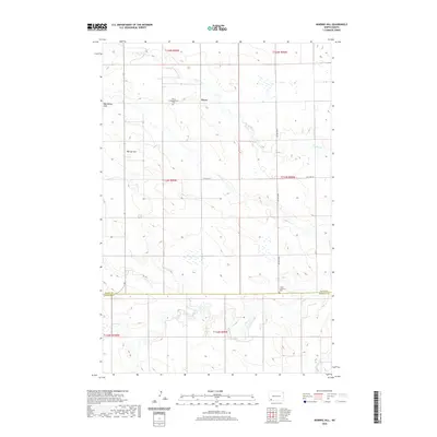
2020 Map of Warnke Hill
USGS Topo · Published 2020About this map
Pierce sits in a high plains landscape where the headwaters of the Cedar Creek drainage begin their southeastward journey across the North Dakota prairie. This area, located near the Slope Co Bowman Co line, is defined by subtle topographic shifts like the Bob Denny Hills and the prominent Warnke Hill. The agricultural and social foundations of the community are visible through the proximity of the Pierce Congregational Cem and the Cedar Lutheran Cem, reflecting the early settlement patterns of the region's homesteaders. A network of sections and section roads, including 75th Ave SW and 128th Ave SW, provides a structured grid for the ranching and farming operations that characterize this part of the state. The drainage system is particularly well-detailed, showing the convergence of N Cedar Cr and S Cedar Cr into the main branch of Cedar Cr.
Find a feature on this map
17 named features on this map. Tap any name to fly to it.
Don’t see what you’re looking for? This feature index may not catch every label — zoom into the map to look around manually.
Map Details
Editions of this 2020 Warnke Hill Map
This is the sole edition of this map. No revisions or reprints were ever made.
Other maps of this area

1953 · Dickinson
USGS Topo · 1:250,000

1957 · Dickinson
USGS Topo · 1:250,000

1969 · Scranton
USGS Topo · 1:24,000

1969 · Scranton NE
USGS Topo · 1:24,000

1973 · White Lake
USGS Topo · 1:24,000

1973 · Warnke Hill
USGS Topo · 1:24,000

1973 · Mineral Springs
USGS Topo · 1:24,000

1973 · Cedar Lake
USGS Topo · 1:24,000

1973 · West Rainy Butte
USGS Topo · 1:24,000

1973 · East Rainy Butte
USGS Topo · 1:24,000