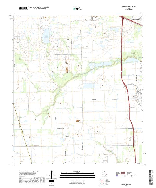
2022 Map of Warren Lake
USGS Topo · Published 2022About this map
Warren Estate Reservoir and a series of private lakes define the low-lying prairie landscape of western Harris County as it undergoes suburban expansion. The transition from large-scale ranching and agriculture to residential development is evident in the grid of established routes like Katy Hockley Rd and Warren Ranch Rd meeting newer arterial parkways. Water management is a central theme, with Cypress Cr and Bear Cr drainage patterns interspersed with named bodies such as Fisher Lake and Mallard Lake. Subtle topographic rises like Wolf Hill and depressions such as Rock Hollow punctuate the flat terrain, while the presence of Green Acres Airport reflects the traditional aviation and sporting uses of the area before the northward reach of Houston fully integrated this territory into the metropolitan corridor.
Find a feature on this map
37 named features on this map. Tap any name to fly to it.
Don’t see what you’re looking for? This feature index may not catch every label — zoom into the map to look around manually.
Map Details
Editions of this 2022 Warren Lake Map
This is the sole edition of this map. No revisions or reprints were ever made.
Other maps of this area

1915 · Cypress
USGS Topo · 1:24,000

1915 · Katy
USGS Topo · 1:24,000

1915 · Addicks
USGS Topo · 1:24,000

1916 · Rose Hill
USGS Topo · 1:24,000

1916 · Hockley
USGS Topo · 1:24,000

1916 · Swanson
USGS Topo · 1:24,000

1918 · Cypress
USGS Topo · 1:31,680

1918 · Addicks
USGS Topo · 1:31,680

1919 · Swanson
USGS Topo · 1:31,680

1920 · Hockley
USGS Topo · 1:31,680