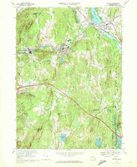
1969 Map of Warren
USGS Topo · Published 1978About this map
The Quaboag River valley serves as the primary corridor for settlement and industry in this late 1960s study, which covers the transition between Worcester and Hampden counties. The Penn Central railroad tracks parallel the river, connecting the industrial centers of Warren and West Warren. These villages are characterized by a high density of civic and religious institutions, including St Pauls Ch and Sacred Heart Ch. To the north, the landscape opens near Wickaboag Pond and the historic elevations of Foster Hill, while the southern reaches are dominated by wooded terrain and isolated summits like Marks Mountain. The mid-century expansion of the regional infrastructure is evident in the path of the Massachusetts Turnpike, which cuts a wide swath across the lower half of the quadrangle, bypassing the traditional town centers in favor of modern high-speed transit.
Find a feature on this map
78 named features on this map. Tap any name to fly to it.
Don’t see what you’re looking for? This feature index may not catch every label — zoom into the map to look around manually.
Map Details
Editions of this 1969 Warren Map
2 editions found
Other maps of this area

1887 · Brookfield
USGS Topo · 1:62,500

1887 · Palmer
USGS Topo · 1:62,500

1887 · Belchertown
USGS Topo · 1:62,500

1887 · Barre
USGS Topo · 1:62,500

1889 · Palmer
USGS Topo · 1:62,500

1889 · Barre
USGS Topo · 1:62,500

1890 · Belchertown
USGS Topo · 1:62,500

1890 · Brookfield
USGS Topo · 1:62,500

1893 · Palmer
USGS Topo · 1:62,500

1893 · Belchertown
USGS Topo · 1:62,500