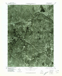
1975 Map of Warren
USGS Topo · Published 1981About this map
The Quaboag River winds through the industrial and residential corridors of Warren and West Warren in this 1975 aerial perspective. This orthophotoquad, produced by the United States Geological Survey in cooperation with the Commonwealth of Massachusetts Department of Public Works, provides a precise visual record of land use before the late-century shifts in New England's manufacturing landscape. The image reveals the dense cluster of structures along the riverbanks, contrasted by the steep, wooded rise of Marks Mountain. To the east, the settlement of West Brookfield sits near the river's path, while the southern portion of the sheet is dominated by forest cover and natural features like Sherman Pond and the prominent Steerage Rock. The map is particularly useful for observing the alignment of transportation routes and the layout of traditional mill towns during the mid-1970s.
Find a feature on this map
8 named features on this map. Tap any name to fly to it.
Don’t see what you’re looking for? This feature index may not catch every label — zoom into the map to look around manually.
Map Details
Editions of this 1975 Warren Map
This is the sole edition of this map. No revisions or reprints were ever made.
Other maps of this area

1887 · Brookfield
USGS Topo · 1:62,500

1887 · Palmer
USGS Topo · 1:62,500

1887 · Belchertown
USGS Topo · 1:62,500

1887 · Barre
USGS Topo · 1:62,500

1889 · Palmer
USGS Topo · 1:62,500

1889 · Barre
USGS Topo · 1:62,500

1890 · Belchertown
USGS Topo · 1:62,500

1890 · Brookfield
USGS Topo · 1:62,500

1893 · Palmer
USGS Topo · 1:62,500

1893 · Belchertown
USGS Topo · 1:62,500