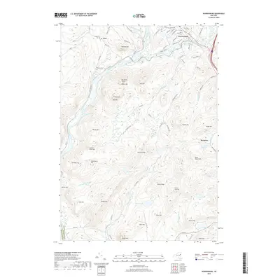
2019 Map of Warrensburg
USGS Topo · Published 2019About this map
The confluence of the Hudson River and the Schroon River anchors this Adirondack landscape, where the settlement of Warrensburg developed as a regional hub. Significant for its river-driven geography, the area is defined by a dense concentration of named peaks and ridges, including The Three Sisters, Huckleberry Mtn, and Hemlock Ridge. Local history and genealogy researchers will find several well-defined burial grounds, such as Warrensburg Cem and the smaller Pendell Cem and Cameron Cem near Athol. The terrain transition from the river valleys to the high ground is marked by complex water systems, including the Big Hollow Reservoir and several upland ponds like Stewart Lake and Viele Pond. Roads such as Old Stage Rd and Stony Creek Rd trace the paths of long-established transportation routes through the rugged Warren County interior.
Find a feature on this map
103 named features on this map. Tap any name to fly to it.
Don’t see what you’re looking for? This feature index may not catch every label — zoom into the map to look around manually.
Map Details
Editions of this 2019 Warrensburg Map
This is the sole edition of this map. No revisions or reprints were ever made.
Other maps of this area

1895 · North Creek
USGS Topo · 1:62,500

1895 · Glens Falls
USGS Topo · 1:62,500

1897 · Bolton
USGS Topo · 1:62,500

1897 · Glens Falls
USGS Topo · 1:62,500

1897 · North Creek
USGS Topo · 1:62,500

1900 · Bolton
USGS Topo · 1:62,500

1903 · Luzerne
USGS Topo · 1:62,500

1938 · Glens Falls
USGS Topo · 1:62,500

1947 · Glens Falls
USGS Topo · 1:62,500

1950 · Glens Falls
USGS Topo · 1:250,000