1923 Map of Warrenville
USGS Topo · Published 1965About this map
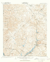
Horse Creek dictates the industrial and social geometry of this South Carolina landscape, anchoring a string of textile and mill settlements including Vaucluse, Graniteville, and Warrenville. These communities are connected by the Southern railroad and the And Augusta Electric line, reflecting the early 20th-century transition from agrarian life to a specialized industrial corridor. Away from the creek valley, the terrain rises into the Sumter National Forest, where a dense network of country churches and schools serves scattered rural populations.
Find a feature on this map
75 named features on this map. Tap any name to fly to it.
Don’t see what you’re looking for? This feature index may not catch every label — zoom into the map to look around manually.
Map Details
Editions of this 1923 Warrenville Map
2 editions found

Other maps of this area

1892 · Mc Cormick
USGS Topo · 1:125,000

1912 · Mc Cormick
USGS Topo · 1:125,000

1920 · Aiken
USGS Topo · 1:48,000

1920 · Talatha
USGS Topo · 1:48,000

1920 · Clarks Hill
USGS Topo · 1:48,000

1921 · Augusta
USGS Topo · 1:62,500

1921 · Aiken
USGS Topo · 1:62,500

1921 · Talatha
USGS Topo · 1:62,500

1921 · Clarks Hill
USGS Topo · 1:62,500

1922 · Hephzibah
USGS Topo · 1:62,500