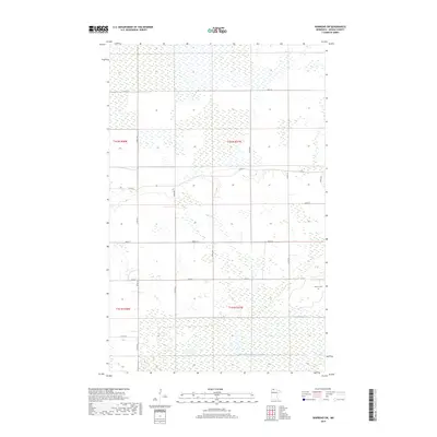
2019 Map of Warroad SW
USGS Topo · Published 2019About this map
America Cem stands as a quiet landmark in this section of Roseau County, situated near the intersection of several rural routes. The landscape is defined by the extensive wetland networks and drainage infrastructure typical of northern Minnesota, specifically represented by the engineered flow of County Ditch Number Twentyfour. This 2019 survey documents a sparse, grid-based settlement pattern where life follows the straight lines of section boundaries and county roads.
Find a feature on this map
19 named features on this map. Tap any name to fly to it.
Don’t see what you’re looking for? This feature index may not catch every label — zoom into the map to look around manually.
Map Details
Editions of this 2019 Warroad SW Map
This is the sole edition of this map. No revisions or reprints were ever made.
Other maps of this area

1918 · Goos
USGS Topo · 1:62,500

1918 · Pencer
USGS Topo · 1:62,500

1918 · Warroad
USGS Topo · 1:62,500

1943 · Goos
USGS Topo · 1:62,500

1943 · Warroad
USGS Topo · 1:62,500

1954 · Roseau
USGS Topo · 1:250,000

1957 · Roseau
USGS Topo · 1:250,000

1958 · Roseau
USGS Topo · 1:250,000
1966 · Salol
USGS Topo · 1:24,000
1966 · Salol NE
USGS Topo · 1:24,000