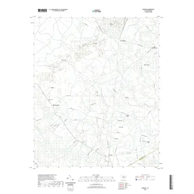
2020 Map of Warsaw
USGS Topo · Published 2020About this map
Morrisville and Old Morrisville anchor a landscape defined by the low-lying wetlands of the coastal plain. The Black River winds through the southwestern quadrant, flanked by numerous bays—distinctive elliptical depressions such as Whites Bay, Dobson Bay, and Big Bay—that characterize this region of South Carolina. This map illustrates a transition from established settlements like Warsaw and Bloomingvale to the deep cypress-and-tupelo bottomlands of the Big Dam Swamp and Campbell Swamp. For genealogists, the inclusion of Elim Cem and Bloomingvale Cem offers precise locations for family history research. The presence of Jordan Private Airport and a network of county roads, including Co Line Rd on the Williamsburg Co and Georgetown Co border, highlights the modern connectivity of this rural stretch.
Find a feature on this map
68 named features on this map. Tap any name to fly to it.
Don’t see what you’re looking for? This feature index may not catch every label — zoom into the map to look around manually.
Map Details
Editions of this 2020 Warsaw Map
This is the sole edition of this map. No revisions or reprints were ever made.
Other maps of this area

1943 · Olin
USGS Topo · 1:31,680

1943 · Trio
USGS Topo · 1:24,000

1943 · Henry
USGS Topo · 1:24,000

1943 · Rhems
USGS Topo · 1:24,000

1943 · Andrews
USGS Topo · 1:24,000

1946 · Indiantown
USGS Topo · 1:62,500

1949 · Georgetown
USGS Topo · 1:250,000

1967 · Georgetown
USGS Topo · 1:250,000

1974 · Georgetown
USGS Topo · 1:250,000

1986 · Georgetown
USGS Topo · 1:100,000