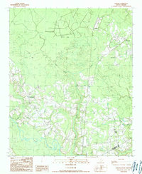
1990 Map of Warsaw
USGS Topo · Published 1990About this map
The Black River meanders across this low-lying landscape along the boundary of Williamsburg and Georgetown Counties. In the late twentieth century, this region remained characterized by a complex network of wetlands and drainage systems, including Thompson Swamp, Baker Swamp, and Big Dam Swamp. Distinctive geological depressions, locally known as bays, dominate the northern half of the map, notably Dobson Bay, Whites Bay, and Lin Whites Bay. These features create a unique mosaic of timberland and pocosin-like terrain.
Find a feature on this map
26 named features on this map. Tap any name to fly to it.
Don’t see what you’re looking for? This feature index may not catch every label — zoom into the map to look around manually.
Map Details
Editions of this 1990 Warsaw Map
This is the sole edition of this map. No revisions or reprints were ever made.
Other maps of this area

1943 · Olin
USGS Topo · 1:31,680

1943 · Trio
USGS Topo · 1:24,000

1943 · Henry
USGS Topo · 1:24,000

1943 · Rhems
USGS Topo · 1:24,000

1943 · Andrews
USGS Topo · 1:24,000

1946 · Indiantown
USGS Topo · 1:62,500

1949 · Georgetown
USGS Topo · 1:250,000

1967 · Georgetown
USGS Topo · 1:250,000

1974 · Georgetown
USGS Topo · 1:250,000

1986 · Georgetown
USGS Topo · 1:100,000