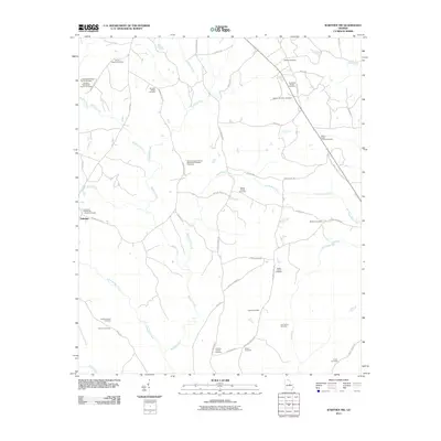
2011 Map of Warthen NW
USGS Topo · Published 2011About this map
Buffalo Creek and its many tributaries, including Pinkston Creek and Sandy Run Creek, carve through this rural landscape in Washington County, Georgia. The 2011 survey reveals a settlement pattern deeply rooted in family landholdings and denominational heritage, centered around the community of Zebulon. A remarkable density of burial sites is documented here, ranging from large churchyards like the Browns Chapel African Methodist Episcopal Cemetery and Mount Hope Church Cemetery to small, private plots such as the Lunsford-Wall-Sisson Family Cemetery and the Garland Family Cemetery.
Find a feature on this map
50 named features on this map. Tap any name to fly to it.
Don’t see what you’re looking for? This feature index may not catch every label — zoom into the map to look around manually.
Map Details
Editions of this 2011 Warthen NW Map
This is the sole edition of this map. No revisions or reprints were ever made.
Other maps of this area

1912 · Milledgeville
USGS Topo · 1:62,500

1953 · Athens
USGS Topo · 1:250,000

1958 · Athens
USGS Topo · 1:250,000

1959 · Athens
USGS Topo · 1:250,000

1960 · Warthen NE
USGS Topo · 1:24,000

1961 · Deepstep
USGS Topo · 1:24,000

1961 · Warthen
USGS Topo · 1:24,000

1961 · Warthen NW
USGS Topo · 1:24,000

1963 · Athens
USGS Topo · 1:250,000

1972 · Shoulderbone
USGS Topo · 1:24,000