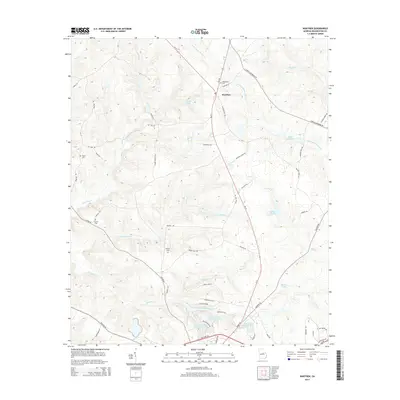
2014 Map of Warthen
USGS Topo · Published 2014About this map
Warthen serves as the central hub of this Georgia landscape, situated at the junction of Ga-102 and Ga-15. The area is characterized by a complex network of waterways that defined early industry and agriculture, including the meandering Williamson Swamp Cr and the waters of Mays Millpond. Family history is deeply rooted here, evidenced by several small burial grounds such as Taylor Cem and Murphy Cem which are tucked away near rural routes like Linton Rd and Peavy Ln. To the south, the landscape transitions toward a series of managed water bodies, most notably the Gilmore Lake Pond Number One and Gilmore Lake Number Three systems. This topography reveals the persistent importance of local timber and farmland, with landmarks like Adams Lake and Walker Pond dotting the drainages of Carters Mill Cr and Little Keg Cr.
Find a feature on this map
62 named features on this map. Tap any name to fly to it.
Don’t see what you’re looking for? This feature index may not catch every label — zoom into the map to look around manually.
Map Details
Editions of this 2014 Warthen Map
This is the sole edition of this map. No revisions or reprints were ever made.
Other maps of this area

1953 · Athens
USGS Topo · 1:250,000

1957 · Macon
USGS Topo · 1:250,000

1958 · Macon
USGS Topo · 1:250,000

1958 · Athens
USGS Topo · 1:250,000

1959 · Athens
USGS Topo · 1:250,000

1960 · Warthen NE
USGS Topo · 1:24,000

1961 · Deepstep
USGS Topo · 1:24,000

1961 · Warthen
USGS Topo · 1:24,000

1961 · Warthen NW
USGS Topo · 1:24,000

1962 · Tabernacle
USGS Topo · 1:24,000