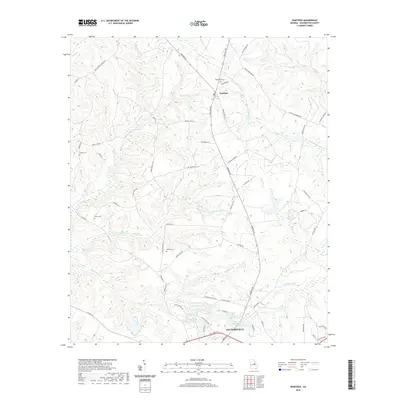
2020 Map of Warthen
USGS Topo · Published 2020About this map
Warthen and the northern fringes of Sandersville anchor this 2020 landscape in Washington County, where the topography is defined by an intricate network of waterways. The drainage pattern is led by Williamson Swamp Cr and Carters Mill Cr, feeding into a series of managed waters like the Gilmore Lake Pond Number One complex. This modern survey reflects a region where agricultural legacies persist through family-named roads such as Wilker Dairy Rd and Magnolia Farm Rd, while also documenting numerous small burial grounds that serve as vital touchstones for local genealogists. From the depths of Hardwood Hollow to the banks of Little Keg Cr, the map records the enduring rural character of central Georgia, tracing the relationship between small-town residential development and the natural draws and branches of the Oconee River watershed.
Find a feature on this map
62 named features on this map. Tap any name to fly to it.
Don’t see what you’re looking for? This feature index may not catch every label — zoom into the map to look around manually.
Map Details
Editions of this 2020 Warthen Map
This is the sole edition of this map. No revisions or reprints were ever made.
Other maps of this area

1953 · Athens
USGS Topo · 1:250,000

1957 · Macon
USGS Topo · 1:250,000

1958 · Macon
USGS Topo · 1:250,000

1958 · Athens
USGS Topo · 1:250,000

1959 · Athens
USGS Topo · 1:250,000

1960 · Warthen NE
USGS Topo · 1:24,000

1961 · Deepstep
USGS Topo · 1:24,000

1961 · Warthen
USGS Topo · 1:24,000

1961 · Warthen NW
USGS Topo · 1:24,000

1962 · Tabernacle
USGS Topo · 1:24,000