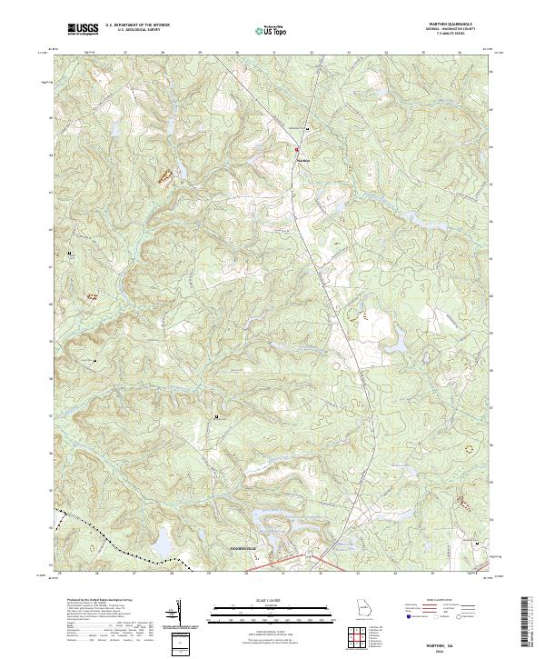
2024 Map of Warthen
USGS Topo · Published 2024About this map
The unincorporated community of Warthen serves as a quiet focal point in northern Washington County, situated at the junction of Highway 15 and local roads like Warthen Rd. This modern survey illustrates a landscape defined by its riparian network, where Williamson-Swamp Creek and Carters Mill Creek wind through the terrain. To the south, the map captures the northern outskirts of Sandersville, showing the development along the Fall Line Fwy and Sparta Rd.
Find a feature on this map
64 named features on this map. Tap any name to fly to it.
Don’t see what you’re looking for? This feature index may not catch every label — zoom into the map to look around manually.
Map Details
Editions of this 2024 Warthen Map
This is the sole edition of this map. No revisions or reprints were ever made.
Other maps of this area

1953 · Athens
USGS Topo · 1:250,000

1957 · Macon
USGS Topo · 1:250,000

1958 · Macon
USGS Topo · 1:250,000

1958 · Athens
USGS Topo · 1:250,000

1959 · Athens
USGS Topo · 1:250,000

1960 · Warthen NE
USGS Topo · 1:24,000

1961 · Deepstep
USGS Topo · 1:24,000

1961 · Warthen
USGS Topo · 1:24,000

1961 · Warthen NW
USGS Topo · 1:24,000

1962 · Tabernacle
USGS Topo · 1:24,000