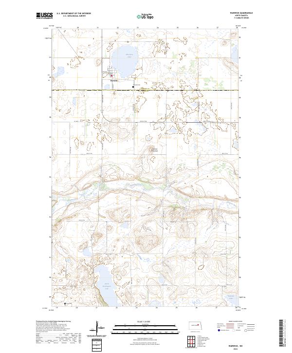
2024 Map of Warwick
USGS Topo · Published 2024About this map
Warwick sits at the northern edge of this landscape, a small prairie settlement near the border of Benson and Eddy counties. The terrain is defined by the winding course of the Sheyenne River, which carves through the central portion of the quadrangle, flanked by numerous glacial depressions and wetlands characteristic of this North Dakota region. To the north, Shin Bone Lake dominates the local drainage, while the southern reaches feature North Washington Lake and Bakstad Lake. Local history is anchored by the Warwick Cem just east of town and the more secluded Knox Cem to the southwest. The presence of Lookout Mountain provides a distinct topographic rise in an otherwise undulating landscape. Large tracts of protected land, such as the Eddy County Waterfowl Production Area, reflect the importance of the region's aquatic habitats for migratory birds.
Find a feature on this map
32 named features on this map. Tap any name to fly to it.
Don’t see what you’re looking for? This feature index may not catch every label — zoom into the map to look around manually.
Map Details
Editions of this 2024 Warwick Map
This is the sole edition of this map. No revisions or reprints were ever made.
Other maps of this area

1928 · Tokio
USGS Topo · 1:62,500

1930 · Hamar
USGS Topo · 1:62,500

1931 · Tokio
USGS Topo · 1:62,500

1944 · Brantford
USGS Topo · 1:62,500

1946 · Brantford
USGS Topo · 1:62,500

1950 · Brantford NE
USGS Topo · 1:24,000

1950 · Tokio
USGS Topo · 1:24,000

1950 · Devils Lake Mountain
USGS Topo · 1:24,000

1951 · Devils Lake Mountain
USGS Topo · 1:24,000

1951 · Free Peoples Lake
USGS Topo · 1:24,000