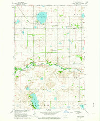
1962 Map of Warwick
USGS Topo · Published 1964About this map
The Warwick settlement and the winding Sheyenne River define this North Dakota landscape during the early 1960s. Situated along the Great Northern railroad, the community serves as a focal point in a region characterized by numerous water bodies, including Shin Bone Lake and the sprawling Lake Washington. This survey captures the transition between Warwick and Minco townships, with the Indian Reservation Boundary following the northern bank of the river. The presence of several Gravel Pits and a river Gaging Station highlights the local industry and hydrological monitoring of the era. Genealogists may find the location of the Warwick Cem particularly useful, while the inclusion of landmarks like Lookout Mountain provides specific geographic context for the surrounding plains and the borders of Benson and Eddy Counties.
Find a feature on this map
19 named features on this map. Tap any name to fly to it.
Don’t see what you’re looking for? This feature index may not catch every label — zoom into the map to look around manually.
Map Details
Editions of this 1962 Warwick Map
This is the sole edition of this map. No revisions or reprints were ever made.
Other maps of this area

1928 · Tokio
USGS Topo · 1:62,500

1930 · Hamar
USGS Topo · 1:62,500

1931 · Tokio
USGS Topo · 1:62,500

1944 · Brantford
USGS Topo · 1:62,500

1946 · Brantford
USGS Topo · 1:62,500

1950 · Brantford NE
USGS Topo · 1:24,000

1950 · Tokio
USGS Topo · 1:24,000

1950 · Devils Lake Mountain
USGS Topo · 1:24,000

1951 · Devils Lake Mountain
USGS Topo · 1:24,000

1951 · Free Peoples Lake
USGS Topo · 1:24,000