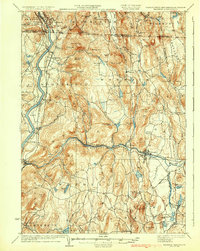
1935 Map of Warwick
USGS Topo · Published 1935About this map
The Connecticut River and Millers River corridors define the topography of this 1935 survey, where the borders of Massachusetts, New Hampshire, and Vermont meet. The landscape is characterized by a dense network of valley settlements and upland summits like Mount Grace and Hogback Mtn. Industrial and transit hubs such as Orange, Millers Falls, and Erving are anchored by the Fitchburg Div and Boston and Maine RR, reflecting the region's historical reliance on rail-and-river commerce.
Find a feature on this map
126 named features on this map. Tap any name to fly to it.
Don’t see what you’re looking for? This feature index may not catch every label — zoom into the map to look around manually.
Map Details
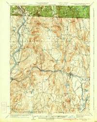
Editions of this 1935 Warwick Map
2 editions found
Other maps of this area

1885 · Northampton
USGS Topo · 1:62,500

1886 · Northampton
USGS Topo · 1:62,500

1887 · Warwick
USGS Topo · 1:62,500

1887 · Belchertown
USGS Topo · 1:62,500

1887 · Winchendon
USGS Topo · 1:62,500

1887 · Barre
USGS Topo · 1:62,500

1889 · Barre
USGS Topo · 1:62,500

1889 · Warwick
USGS Topo · 1:62,500

1890 · Belchertown
USGS Topo · 1:62,500

1890 · Greenfield
USGS Topo · 1:62,500