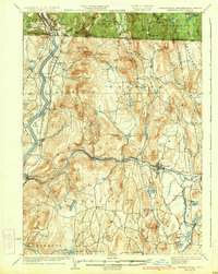
1935 Map of Warwick
USGS Topo · Published 1935About this map
The Connecticut River and Millers River define the industrial and agricultural corridors of Franklin County on this 1935 edition, based on surveys from 1887 and 1932. The landscape is characterized by the convergence of major rail lines, including the Central Vermont Ry and the Boston and Maine RR, which serviced manufacturing hubs and village centers like Orange and Millers Falls. In the uplands, the village of Warwick sits in the shadow of Mount Grace, surrounded by numerous peaks such as Notch Mountain and Strobridge Hill. Genealogists and local historians will find significant detail in the northern borderlands between Massachusetts, New Hampshire, and Vermont, where the map identifies local landmarks like the Barber Sch and Barrows Cem. The presence of small settlements such as Farley, Erving, and Lock Village illustrates the distributed settlement pattern of the early twentieth century before modern highway expansion shifted local commerce.
Find a feature on this map
121 named features on this map. Tap any name to fly to it.
Don’t see what you’re looking for? This feature index may not catch every label — zoom into the map to look around manually.
Map Details
Editions of this 1935 Warwick Map
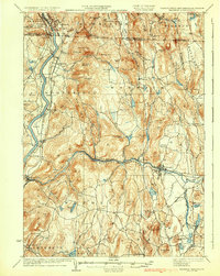
2 editions found
Other maps of this area

1885 · Northampton
USGS Topo · 1:62,500

1886 · Northampton
USGS Topo · 1:62,500

1887 · Warwick
USGS Topo · 1:62,500

1887 · Belchertown
USGS Topo · 1:62,500

1887 · Winchendon
USGS Topo · 1:62,500

1887 · Barre
USGS Topo · 1:62,500

1889 · Barre
USGS Topo · 1:62,500

1889 · Warwick
USGS Topo · 1:62,500

1890 · Belchertown
USGS Topo · 1:62,500

1890 · Greenfield
USGS Topo · 1:62,500