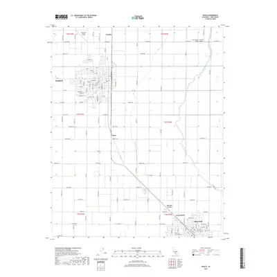
2018 Map of Wasco
USGS Topo · Published 2018About this map
Agricultural development and industrial transit define this portion of the San Joaquin Valley in Kern County. The city of Wasco serves as a primary hub, showing a grid of residential streets like Sycamore Dr and Birch Ave near the Wasco-Kern County Airport. To the southeast, the expansion of Shafter and the smaller settlement of North Shafter indicate the ongoing growth of these interior valley communities. The landscape is heavily structured by water management and transportation, featuring the Calloway Canal and various rural junctions such as Myricks Corner, Palmo, and Neufeld. The rectilinear road network, including long thoroughfares like Root Ave and McCombs Ave, reflects the systematic land divisions typical of California's Central Valley farming regions.
Find a feature on this map
97 named features on this map. Tap any name to fly to it.
Don’t see what you’re looking for? This feature index may not catch every label — zoom into the map to look around manually.
Map Details
Editions of this 2018 Wasco Map
This is the sole edition of this map. No revisions or reprints were ever made.
Other maps of this area

1910 · Buena Vista Lake
USGS Topo · 1:125,000

1912 · Buena Vista Lake
USGS Topo · 1:125,000

1927 · McFarland
USGS Topo · 1:31,680

1930 · McFarland
USGS Topo · 1:31,680

1930 · Leonards
USGS Topo · 1:31,680

1930 · Hamlin School
USGS Topo · 1:31,680

1930 · Wasco
USGS Topo · 1:31,680

1930 · Pond
USGS Topo · 1:31,680

1930 · Famoso
USGS Topo · 1:31,680

1930 · Rosedale
USGS Topo · 1:31,680