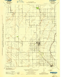
1943 Map of Wasco
USGS Topo · Published 1943About this map
Wasco Oil Field and scattered gas fields define the industrial landscape of this Kern County region during the early 1940s. The grid-patterned agricultural lands are anchored by the growing town of Wasco and the rail hub at Shafter to the south. Transportation is dominated by the Atchison Topeka and Santa Fe railroad, which parallels a corridor of small settlements including Palmo, Elmo, and Petro. The geography transitions from the irrigated fields of the valley floor up toward the distinct elevation of Semitropic Ridge. Local community life is evidenced by rural landmarks like Pondham Sch and Maple Sch, alongside several family-named ranch properties such as Rowlee Ranch and Schleifer Ranch. These details reveal a landscape of coordinated resource extraction and systematic desert irrigation before the post-war expansion of the Central Valley.
Find a feature on this map
63 named features on this map. Tap any name to fly to it.
Don’t see what you’re looking for? This feature index may not catch every label — zoom into the map to look around manually.
Map Details
Editions of this 1943 Wasco Map
This is the sole edition of this map. No revisions or reprints were ever made.
Other maps of this area

1910 · Buena Vista Lake
USGS Topo · 1:125,000

1912 · McKittrick
USGS Topo · 1:125,000

1912 · Buena Vista Lake
USGS Topo · 1:125,000

1914 · Lost Hills
USGS Topo · 1:125,000

1927 · McFarland
USGS Topo · 1:31,680

1927 · Semitropic
USGS Topo · 1:31,680

1929 · Delano
USGS Topo · 1:31,680

1929 · Hacienda Ranch
USGS Topo · 1:31,680

1929 · Stone
USGS Topo · 1:31,680

1929 · Allensworth
USGS Topo · 1:31,680