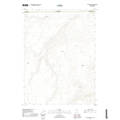
2018 Map of Washburn Basin
USGS Topo · Published 2018About this map
Washburn Basin defines the high-desert landscape at the border of Oregon and Nevada, where the drainage systems of Washburn Cr and Little Washburn Cr converge. This 2018 survey reveals a topography of high plateaus and deep cuts, most notably around the volcanic prominence of Black Mtn. The terrain is marked by a series of essential water sources for cattle and wildlife, including Old Corral Spring, Rock Spring, and Mud Spring, which have historically dictated the patterns of movement through this corner of Malheur County.
Find a feature on this map
24 named features on this map. Tap any name to fly to it.
Don’t see what you’re looking for? This feature index may not catch every label — zoom into the map to look around manually.
Map Details
Editions of this 2018 Washburn Basin Map
This is the sole edition of this map. No revisions or reprints were ever made.
Other maps of this area

1882 · Paradise
USGS Topo · 1:250,000

1886 · Disaster
USGS Topo · 1:250,000

1893 · Paradise
USGS Topo · 1:250,000

1893 · Disaster
USGS Topo · 1:250,000

1954 · Vya
USGS Topo · 1:250,000

1955 · McDermitt
USGS Topo · 1:250,000

1955 · Jordan Valley
USGS Topo · 1:250,000

1955 · Adel
USGS Topo · 1:250,000

1957 · Adel
USGS Topo · 1:250,000

1957 · Jordan Valley
USGS Topo · 1:250,000