
Loading...
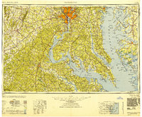
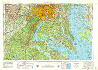
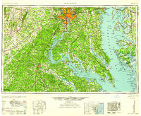
Loading map...1948 Map of Washington
USGS Topo · Published 1948About this map
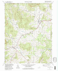
The Potomac River and Chesapeake Bay define this mid-century landscape, illustrating the critical maritime and military infrastructure of the National Capital Region. In the years following World War II, the area is characterized by a high concentration of federal installations, from the U.S. Naval Academy in Annapolis to the sprawling Fort Belvoir Military Reservation. The map captures the transition from the densely populated urban centers of Washington and Alexandria to the rural Tidewater and the Blue Ridge foothills.
Find a feature on this map
151 named features on this map. Tap any name to fly to it.
Don’t see what you’re looking for? This feature index may not catch every label — zoom into the map to look around manually.
Map Details
Date Portrayed1948
Date Published1948
PublisherU.S. Geological Survey
Map TypeTopographic
Scale1:250000
Physical Dimensions31.6 x 24.2 inches
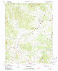
Editions of this 1948 Washington Map
2 editions found
Historical Maps of Mount Rainier Through Time
7 maps found

Featured Locations
Source Details
SourceU.S. Geological Survey
CopyrightPublic Domain