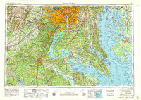
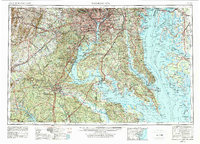
1957 Map of Washington
USGS Topo · Published 1979About this map
Shenandoah National Park and the rugged peaks of Big Cobbler Mtn overlook the western reaches of this mid-century landscape. The map details the complex geography of the Tidewater region, where the Potomac River and Rappahannock River flow toward the expansive Chesapeake Bay. Major infrastructure including the Pentagon and Mount Vernon stand alongside a massive network of military and federal installations like the Quantico Marine Corps Base and the Dahlgren Naval Weapons Center. Along the eastern shore, the Blackwater National Wildlife Refuge and numerous islands such as Kent Island and the Hooper Islands reflect the era's conservation and coastal character. Extensive rail networks, including the Southern Ry and the Richmond Fredericksburg & Potomac RR, connect historic hubs like Alexandria, Annapolis, and Fredericksburg.
Find a feature on this map
172 named features on this map. Tap any name to fly to it.
Don’t see what you’re looking for? This feature index may not catch every label — zoom into the map to look around manually.
Map Details
Editions of this 1957 Washington Map
5 editions found
Other maps of this area

1884 · Harpers Ferry
USGS Topo · 1:125,000

1887 · Spottsylvania
USGS Topo · 1:125,000

1889 · Fredericksburg
USGS Topo · 1:125,000

1890 · Goochland
USGS Topo · 1:125,000

1890 · Mt. Vernon
USGS Topo · 1:125,000

1891 · Harpers Ferry
USGS Topo · 1:125,000

1891 · Palmyra
USGS Topo · 1:125,000

1891 · Mt. Vernon
USGS Topo · 1:125,000

1892 · Leonardtown
USGS Topo · 1:62,500

1892 · Laurel
USGS Topo · 1:62,500