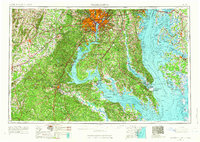
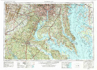
1957 Map of Washington
USGS Topo · Published 1966About this map
Washington, Alexandria, and Annapolis anchor this mid-century view of the mid-Atlantic, showing the rapid expansion of suburban corridors during the post-war era. The sheet documents a landscape where traditional maritime economies along the Chesapeake Bay and Potomac River met an increasing federal and military footprint. Significant installations such as the Quantico Marine Corps Base, Naval Air Test Center, and Fort Meade are prominently featured, reflecting the Cold War-era intensification of the region's defense infrastructure.
Find a feature on this map
335 named features on this map. Tap any name to fly to it.
Don’t see what you’re looking for? This feature index may not catch every label — zoom into the map to look around manually.
Map Details
Editions of this 1957 Washington Map
5 editions found
Other maps of this area

1884 · Harpers Ferry
USGS Topo · 1:125,000

1887 · Spottsylvania
USGS Topo · 1:125,000

1889 · Fredericksburg
USGS Topo · 1:125,000

1890 · Goochland
USGS Topo · 1:125,000

1890 · Mt. Vernon
USGS Topo · 1:125,000

1891 · Harpers Ferry
USGS Topo · 1:125,000

1891 · Palmyra
USGS Topo · 1:125,000

1891 · Mt. Vernon
USGS Topo · 1:125,000

1892 · Leonardtown
USGS Topo · 1:62,500

1892 · Laurel
USGS Topo · 1:62,500