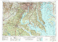
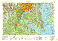
1957 Map of Washington
USGS Topo · Published 1979About this map
The US Capitol and the White House stand at the center of this 1950s regional landscape, which documents the mid-century evolution of the nation's capital and its surrounding tidal reaches. As the suburbs of Bethesda and Silver Spring densify, the map traces the deep history of the Chesapeake region, from St Marys City to the plantation grounds of Mount Vernon and Stratford Hall. The vast waterways of the Chesapeake Bay and Potomac River define the local economy and geography, dotted with critical maritime and military installations like the Patuxent River NAS and Quantico Marine Corps Base. The transition from the urban core of Washington to the rural Eastern Shore, including Blackwater National Wildlife Refuge, highlights a period when the Penn Central RR and B & O RR still moved goods alongside the emerging interstate system.
Find a feature on this map
266 named features on this map. Tap any name to fly to it.
Don’t see what you’re looking for? This feature index may not catch every label — zoom into the map to look around manually.
Map Details
Editions of this 1957 Washington Map
5 editions found
Other maps of this area

1884 · Harpers Ferry
USGS Topo · 1:125,000

1887 · Spottsylvania
USGS Topo · 1:125,000

1889 · Fredericksburg
USGS Topo · 1:125,000

1890 · Goochland
USGS Topo · 1:125,000

1890 · Mt. Vernon
USGS Topo · 1:125,000

1891 · Harpers Ferry
USGS Topo · 1:125,000

1891 · Palmyra
USGS Topo · 1:125,000

1891 · Mt. Vernon
USGS Topo · 1:125,000

1892 · Leonardtown
USGS Topo · 1:62,500

1892 · Laurel
USGS Topo · 1:62,500