
Loading...
Loading map...1961 Map of Washington
USGS Topo · Published 1961About this map
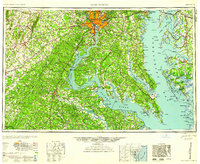
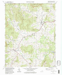
Washington and the expanding suburbs of Alexandria, Arlington, and Bethesda anchor this mid-century survey of the Mid-Atlantic region. The map captures the corridor before the full arrival of the modern interstate system, showing the early reach of Interstate 95 alongside historic routes like U S Highway 1 and the Pennsylvania RR. The landscape transitions from the urban center to the preservation lands of Prince William Forest Park and the deeply indented shorelines of the Potomac River and Chesapeake Bay.
Find a feature on this map
178 named features on this map. Tap any name to fly to it.
Don’t see what you’re looking for? This feature index may not catch every label — zoom into the map to look around manually.
Map Details
Date Portrayed1961
Date Published1961
PublisherU.S. Geological Survey
Map TypeTopographic
Scale1:250000
Physical Dimensions29.1 x 22.1 inches
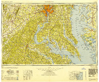
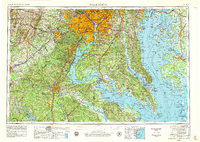
Editions of this 1961 Washington Map
2 editions found
Historical Maps of Mount Rainier Through Time
7 maps found

Featured Locations
Source Details
SourceU.S. Geological Survey
CopyrightPublic Domain