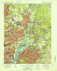
1951 Map of Washington East
USGS Topo · Published 1951About this map
The University of Maryland and the College Park Airport anchor the northern landscape of this survey, which documents the rapid mid-century expansion along the Maryland-District of Columbia border. Dense residential growth is evident in planned communities such as University Park, Hyattsville, and Mount Rainier, which are woven together by the routes of the Baltimore and Ohio RR and the Pennsylvania RR.
Find a feature on this map
214 named features on this map. Tap any name to fly to it.
Don’t see what you’re looking for? This feature index may not catch every label — zoom into the map to look around manually.
Map Details
Editions of this 1951 Washington East Map
This is the sole edition of this map. No revisions or reprints were ever made.
Other maps of this area

1890 · Mt. Vernon
USGS Topo · 1:125,000

1891 · Mt. Vernon
USGS Topo · 1:125,000

1892 · Laurel
USGS Topo · 1:62,500

1893 · Frederick
USGS Topo · 1:125,000

1894 · Laurel
USGS Topo · 1:62,500

1894 · Frederick
USGS Topo · 1:125,000

1894 · Mt. Vernon
USGS Topo · 1:125,000

1897 · Laurel
USGS Topo · 1:62,500

1897 · Mt. Vernon
USGS Topo · 1:125,000

1899 · Patuxent
USGS Topo · 1:125,000