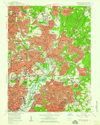
1956 Map of Washington East
USGS Topo · Published 1959About this map
The Anacostia River serves as the central artery for this mid-century survey, dividing the dense urban expansion of the District of Columbia from the developing suburbs of Prince George's County. In Maryland, the University of Maryland campus and the historic College Park Airport anchor the northern landscape, while residential growth is visible in neighborhoods like Takoma Park and Langley Park. The map reveals a land heavily utilized for public and institutional purposes, from the expansive National Arboretum and Kenilworth Aquatic Gardens to a series of Civil War-era defensive sites including Fort Bunker Hill and Fort Totten.
Find a feature on this map
249 named features on this map. Tap any name to fly to it.
Don’t see what you’re looking for? This feature index may not catch every label — zoom into the map to look around manually.
Map Details
Editions of this 1956 Washington East Map
This is the sole edition of this map. No revisions or reprints were ever made.
Other maps of this area

1890 · Mt. Vernon
USGS Topo · 1:125,000

1891 · Mt. Vernon
USGS Topo · 1:125,000

1892 · Laurel
USGS Topo · 1:62,500

1893 · Frederick
USGS Topo · 1:125,000

1894 · Laurel
USGS Topo · 1:62,500

1894 · Frederick
USGS Topo · 1:125,000

1894 · Mt. Vernon
USGS Topo · 1:125,000

1897 · Laurel
USGS Topo · 1:62,500

1897 · Mt. Vernon
USGS Topo · 1:125,000

1899 · Patuxent
USGS Topo · 1:125,000