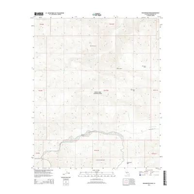
2015 Map of Washington Wash
USGS Topo · Published 2015About this map
Joshua Tree National Park encompasses the central portion of this desert landscape, where the Hexie Mountains and Cottonwood Mountains meet. The terrain is defined by a complex drainage network, characterized by several significant seasonal washes that cut through the Mojave Desert. Notable among these are Washington Wash and Porcupine Wash, which flow through the northern reaches, while Smoke Tree Wash and Pinkham Wash drain the southern sections. This 2015 U.S. Geological Survey representation documents the arid geography of the Pinkham Canyon area, providing a precise record of elevations and landforms such as Monument Mtn. Human presence is represented primarily by primitive access routes like the Pinkham Canyon Trl and Thermal Canyon Rd, tracing the paths through the high-desert basins.
Find a feature on this map
21 named features on this map. Tap any name to fly to it.
Don’t see what you’re looking for? This feature index may not catch every label — zoom into the map to look around manually.
Map Details
Editions of this 2015 Washington Wash Map
This is the sole edition of this map. No revisions or reprints were ever made.
Other maps of this area

1904 · Indio
USGS Topo · 1:125,000

1940 · Cottonwood Spring
USGS Topo · 1:62,500

1941 · Coachella
USGS Topo · 1:62,500

1943 · Coachella
USGS Topo · 1:62,500

1943 · Pinkham Well
USGS Topo · 1:62,500

1944 · Cottonwood Spring
USGS Topo · 1:62,500

1944 · Pinkham Well
USGS Topo · 1:62,500

1944 · Pinyon Well
USGS Topo · 1:62,500

1947 · Santa Ana
USGS Topo · 1:250,000

1949 · Santa Ana
USGS Topo · 1:250,000