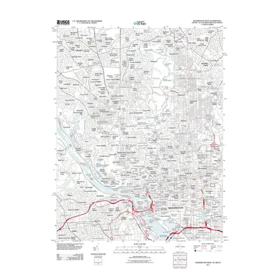
2011 Map of Washington West
USGS Topo · Published 2011About this map
The Potomac River carves through the heart of the capital region, separating the federal districts and Maryland suburbs from the burgeoning neighborhoods of Northern Virginia. This detailed survey captures the institutional density of the city, from The White House and the Washington Monument to the academic hubs of Georgetown University and American University. The landscape is a network of circles and squares, including Dupont Circle and McPherson Square, which define the city's unique radial planning. Beyond the marble monuments, the map reveals the extensive green spaces of Rock Creek Park Public Golf Course and the solemn grounds of Arlington National Cemetery. Significant infrastructure such as the Union Station Post Office and the Jersey Railroad Yard highlight the city's role as a primary transportation and logistics hub for the East Coast.
Find a feature on this map
275 named features on this map. Tap any name to fly to it.
Don’t see what you’re looking for? This feature index may not catch every label — zoom into the map to look around manually.
Map Details
Editions of this 2011 Washington West Map
This is the sole edition of this map. No revisions or reprints were ever made.
Other maps of this area

1890 · Mt. Vernon
USGS Topo · 1:125,000

1891 · Mt. Vernon
USGS Topo · 1:125,000

1892 · Laurel
USGS Topo · 1:62,500

1893 · Frederick
USGS Topo · 1:125,000

1894 · Laurel
USGS Topo · 1:62,500

1894 · Frederick
USGS Topo · 1:125,000

1894 · Mt. Vernon
USGS Topo · 1:125,000

1897 · Laurel
USGS Topo · 1:62,500

1897 · Mt. Vernon
USGS Topo · 1:125,000

1899 · Patuxent
USGS Topo · 1:125,000