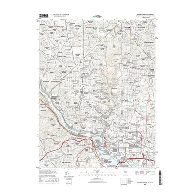
2016 Map of Washington West
USGS Topo · Published 2016About this map
The National Mall and its surrounding federal infrastructure anchor this detailed 2016 study of the nation's capital and its Maryland and Virginia suburbs. Centered on the White House and Capitol, the map documents the dense concentration of memorials and government institutions, including the Washington Monument and Lincoln Memorial along the Tidal Basin. The landscape is defined by the Potomac River and the winding Rock Creek, which carves through the expansive Rock Creek Park.
Find a feature on this map
170 named features on this map. Tap any name to fly to it.
Don’t see what you’re looking for? This feature index may not catch every label — zoom into the map to look around manually.
Map Details
Editions of this 2016 Washington West Map
This is the sole edition of this map. No revisions or reprints were ever made.
Other maps of this area

1890 · Mt. Vernon
USGS Topo · 1:125,000

1891 · Mt. Vernon
USGS Topo · 1:125,000

1892 · Laurel
USGS Topo · 1:62,500

1893 · Frederick
USGS Topo · 1:125,000

1894 · Laurel
USGS Topo · 1:62,500

1894 · Frederick
USGS Topo · 1:125,000

1894 · Mt. Vernon
USGS Topo · 1:125,000

1897 · Laurel
USGS Topo · 1:62,500

1897 · Mt. Vernon
USGS Topo · 1:125,000

1899 · Patuxent
USGS Topo · 1:125,000