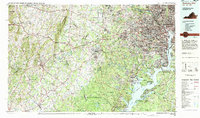
1982 Map of Washington West
USGS Topo · Published 1983About this map
The Potomac River corridor south and west of the nation's capital showcases a landscape shaped by rapid suburban expansion and massive federal installations in the early 1980s. High-density residential growth defines the Virginia corridor between Alexandria and Fairfax, while the southern reaches near Woodbridge and Dale City mark the transition toward the sprawling Prince William Forest Park and the Marine Corps Development and Education Command (Quantico).
Find a feature on this map
117 named features on this map. Tap any name to fly to it.
Don’t see what you’re looking for? This feature index may not catch every label — zoom into the map to look around manually.
Map Details
Editions of this 1982 Washington West Map
This is the sole edition of this map. No revisions or reprints were ever made.
Other maps of this area

1884 · Harpers Ferry
USGS Topo · 1:125,000

1887 · Spottsylvania
USGS Topo · 1:125,000

1889 · Fredericksburg
USGS Topo · 1:125,000

1890 · Mt. Vernon
USGS Topo · 1:125,000

1891 · Harpers Ferry
USGS Topo · 1:125,000

1891 · Mt. Vernon
USGS Topo · 1:125,000

1892 · Laurel
USGS Topo · 1:62,500

1892 · Fredericksburg
USGS Topo · 1:125,000

1892 · Spottsylvania
USGS Topo · 1:125,000

1892 · Brandywine
USGS Topo · 1:62,500