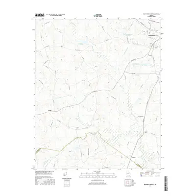
2017 Map of Washington West
USGS Topo · Published 2017About this map
Washington serves as a prominent focal point in this 2017 survey, where residential streets like Lexington Ave and Peachtree St give way to the sprawling rural landscape of Wilkes County. The region is defined by its complex network of water bodies, from the City of Washington Reservoir to the Little River marking the southwestern border with Taliaferro County. Local landmarks such as Beaverdam Creek Lake and Burdette-Harris Lake Number One are interspersed with small settlements like Tyrone and Ficklin.
Find a feature on this map
71 named features on this map. Tap any name to fly to it.
Don’t see what you’re looking for? This feature index may not catch every label — zoom into the map to look around manually.
Map Details
Editions of this 2017 Washington West Map
This is the sole edition of this map. No revisions or reprints were ever made.
Other maps of this area

1906 · Crawfordville
USGS Topo · 1:125,000

1953 · Athens
USGS Topo · 1:250,000

1955 · Tignall
USGS Topo · 1:24,000

1958 · Athens
USGS Topo · 1:250,000

1959 · Athens
USGS Topo · 1:250,000

1963 · Athens
USGS Topo · 1:250,000

1966 · Philomath
USGS Topo · 1:24,000

1966 · Crawfordville
USGS Topo · 1:24,000
1971 · Celeste
USGS Topo · 1:24,000
1971 · Rayle
USGS Topo · 1:24,000