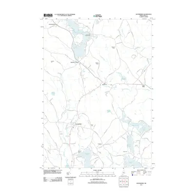
2011 Map of Waterboro
USGS Topo · Published 2011About this map
Little Ossipee Pond dominates the northern landscape of this York County region, serving as a focal point for the surrounding settlements of North Waterboro, Waterboro Center, and East Waterboro. The presence of the Little Ossipee Lake Seaplane Base indicates the importance of water-based transport and recreation in this part of Maine. Moving south, the terrain is defined by a series of prominent elevations like Ossipee Hill and Roberts Ridge, which channel drainage into complex brook systems including Cooks Brook and Carll Branch. Local history is preserved in sites like the Chadbourne Cemetery and the Scotts Cove Camping Area on the shores of Bunganut Pond. The southern reaches of the map transition into a lakeland environment featuring Swan Pond, Roberts Pond, and the northern tip of Kennebunk Pond.
Find a feature on this map
105 named features on this map. Tap any name to fly to it.
Don’t see what you’re looking for? This feature index may not catch every label — zoom into the map to look around manually.
Map Details
Editions of this 2011 Waterboro Map
This is the sole edition of this map. No revisions or reprints were ever made.
Other maps of this area

1891 · Berwick
USGS Topo · 1:62,500

1891 · Kennebunk
USGS Topo · 1:62,500

1891 · Buxton
USGS Topo · 1:62,500

1891 · Newfield
USGS Topo · 1:62,500

1892 · Buxton
USGS Topo · 1:62,500

1893 · Kennebunk
USGS Topo · 1:62,500

1893 · Berwick
USGS Topo · 1:62,500

1893 · Buxton
USGS Topo · 1:62,500

1893 · Newfield
USGS Topo · 1:62,500

1898 · Kennebunk
USGS Topo · 1:62,500