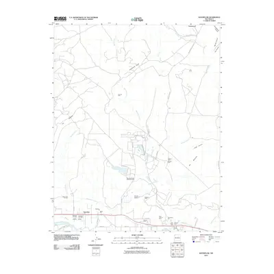
2010 Map of Waterflow
USGS Topo · Published 2010About this map
The San Juan River corridor in northwest New Mexico defines this landscape, where early 21st-century energy production meets historical agricultural irrigation. Irrigation infrastructure like the Farmers Mutual Ditch and Jewett Valley Ditch parallels the river, supporting the settlements of Waterflow and Jewett Valley. This area is a significant hub for mineral extraction and power generation, evidenced by the large San Juan Power Generation Dam and a dense concentration of mining operations including the San Juan Underground Test Mine, Black Diamond Mines, and the Verde Oil Field. Genealogy researchers will find the Jewett Valley Cemetery and Waterflow Cemetery situated near the residential clusters, while the Zia Trading Post and Waterflow Post Office mark the community's commercial heart along the primary valley road. To the north, the terrain transitions into complex drainage systems like Westwater Arroyo and Shumway Arroyo.
Find a feature on this map
46 named features on this map. Tap any name to fly to it.
Don’t see what you’re looking for? This feature index may not catch every label — zoom into the map to look around manually.
Map Details
Editions of this 2010 Waterflow Map
This is the sole edition of this map. No revisions or reprints were ever made.
Other maps of this area

1889 · Chaco
USGS Topo · 1:250,000

1892 · Chaco
USGS Topo · 1:250,000

1927 · Sulphur Spring
USGS Topo · 1:96,000

1928 · Kirtland
USGS Topo · 1:125,000

1932 · Kirtland
USGS Topo · 1:125,000

1934 · Chimney Rock
USGS Topo · 1:62,500

1936 · Chimney Rock
USGS Topo · 1:62,500

1954 · Shiprock
USGS Topo · 1:250,000

1958 · Shiprock
USGS Topo · 1:250,000

1959 · Shiprock
USGS Topo · 1:250,000