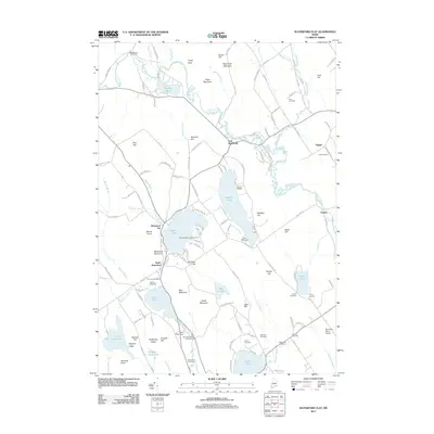
2011 Map of Waterford Flat
USGS Topo · Published 2011About this map
Waterford Flat and the surrounding villages of South Waterford and East Waterford anchor this study of the Oxford Hills region as it appeared in the early 21st century. The landscape is defined by its abundance of water bodies and prominent granite-inflected terrain, including Mount Tire'm and Bear Mountain. The mapping of small, named settlements like Sodom and Yagger provides a detailed look at the rural residential patterns of the area. For genealogists, the map is particularly valuable for its precise location of numerous burial grounds, such as the Bisbeetown Cemetery, Finnish Cemetery, and Elm Vale Cemetery. The presence of several lakeside camps, including Camp Wigwam and Camp McWain, highlights the seasonal recreational character of Keoka Lake and McWain Pond, while the Mountain View Airport marks the localized aviation infrastructure of the period.
Find a feature on this map
142 named features on this map. Tap any name to fly to it.
Don’t see what you’re looking for? This feature index may not catch every label — zoom into the map to look around manually.
Map Details
Editions of this 2011 Waterford Flat Map
This is the sole edition of this map. No revisions or reprints were ever made.
Other maps of this area

1896 · Norway
USGS Topo · 1:62,500

1909 · Fryeburg
USGS Topo · 1:62,500

1911 · Fryeburg
USGS Topo · 1:62,500

1911 · Bryant Pond
USGS Topo · 1:62,500

1914 · Bethel
USGS Topo · 1:62,500

1914 · Bryant Pond
USGS Topo · 1:62,500

1940 · Bethel
USGS Topo · 1:62,500

1941 · Bethel
USGS Topo · 1:62,500

1941 · Fryeburg
USGS Topo · 1:62,500

1942 · Bryant Pond
USGS Topo · 1:62,500