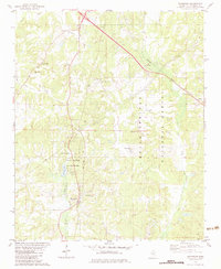
1982 Map of Waterford
USGS Topo · Published 1983About this map
Holly Springs National Forest dominates the eastern half of this Marshall County landscape, where the mixed pine and hardwood terrain is dotted with several rural religious and burial sites. The community of Waterford serves as a central point of interest, situated near the intersection of various local roads and the Burlington Northern railroad line. To the west, Wall Doxey State Park provides a concentrated area of recreation centered on Lake Daroma and Spring Lake, reflecting a mid-20th-century transition toward conservation and public parkland.
Find a feature on this map
30 named features on this map. Tap any name to fly to it.
Don’t see what you’re looking for? This feature index may not catch every label — zoom into the map to look around manually.
Map Details
Editions of this 1982 Waterford Map
This is the sole edition of this map. No revisions or reprints were ever made.
Other maps of this area

1944 · Tyro
USGS Topo · 1:62,500

1944 · Potts Camp
USGS Topo · 1:62,500

1945 · Potts Camp
USGS Topo · 1:62,500

1948 · Byhalia
USGS Topo · 1:62,500

1953 · Holly Springs
USGS Topo · 1:62,500

1956 · Tupelo
USGS Topo · 1:250,000

1958 · Tupelo
USGS Topo · 1:250,000

1964 · Waterford
USGS Topo · 1:24,000

1964 · Holly Springs SE
USGS Topo · 1:24,000
1965 · Holly Springs
USGS Topo · 1:24,000