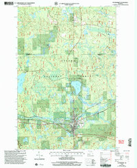
1999 Map of Watersmeet
USGS Topo · Published 2005About this map
Watersmeet serves as the primary hub of activity in this northern Michigan landscape, situated where the Middle Branch Ontonagon River flows through the dense timberlands of the Ottawa National Forest. The geography is defined by a glacial legacy of scattered water bodies, including Bass Lake, Sucker Lake, and Deer Lake, alongside the protected reaches of the Sylvania Wilderness. The map reveals the infrastructure of a community deeply connected to its natural environment, from the sewage treatment plant and gravel pits supporting local industry to the Canoe Access and Boat Launch Ramp providing entry points for recreation. To the north, the small settlement of Bonifas sits near the crossing of Bass Lake Rd, while local history is anchored by the village Cem and natural landmarks such as Ajibikoka Falls and Big Rock.
Find a feature on this map
35 named features on this map. Tap any name to fly to it.
Don’t see what you’re looking for? This feature index may not catch every label — zoom into the map to look around manually.
Map Details
Editions of this 1999 Watersmeet Map
This is the sole edition of this map. No revisions or reprints were ever made.
Other maps of this area

1938 · Phelps
USGS Topo · 1:48,000

1946 · Star Lake
USGS Topo · 1:48,000

1950 · Phelps
USGS Topo · 1:48,000

1950 · Star Lake
USGS Topo · 1:48,000

1952 · Watersmeet
USGS Topo · 1:62,500

1952 · Thayer
USGS Topo · 1:62,500

1955 · Starlake
USGS Topo · 1:62,500

1956 · Phelps
USGS Topo · 1:62,500

1958 · Iron River
USGS Topo · 1:250,000

1960 · Iron River
USGS Topo · 1:250,000