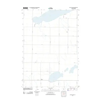
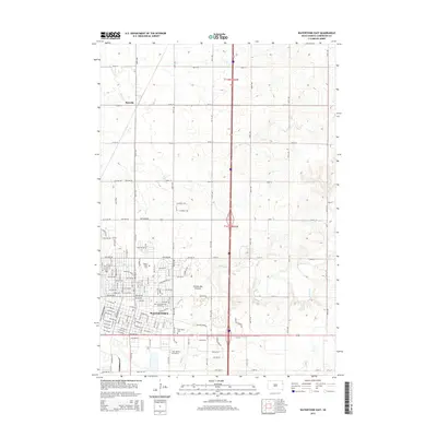
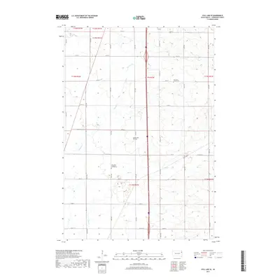
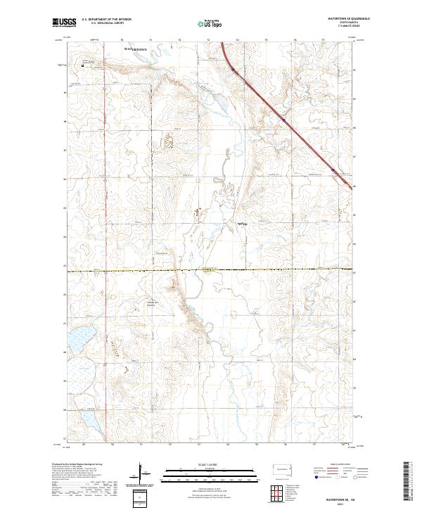
1969 Map of Watertown SE
USGS Topo · Published 1972About this map
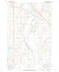
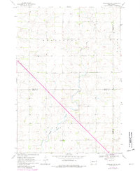
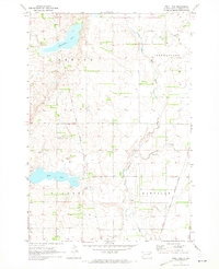
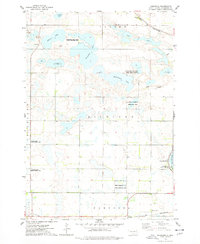
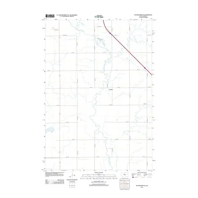
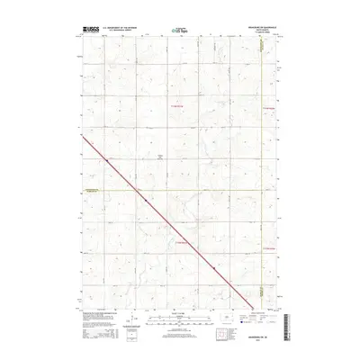
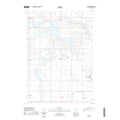
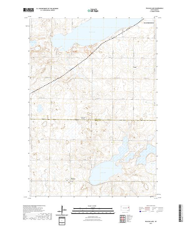
Big Sioux River meanders southward through the center of this terrain, defining the agricultural landscape of Sheridan Twp and Castlewood in the late 1960s. The southeastern fringe of Watertown is visible in the upper northwest corner, featuring landmarks such as the Harmony Hill High Sch and the Radio Towers (KWAT). This era was marked by the presence of the Chicago and North Western railroad line, which crosses the river valley and passes near the small settlement of Appleby. The topography is dotted with numerous Gravel Pits, signaling the importance of local material extraction for the region's development. Downstream, the river is joined by Willow Creek and flows past the distinct wetlands of Five Ponds, illustrating the natural drainage patterns that shaped the county boundaries between Codington and Hamlin counties.
Find a feature on this map
19 named features on this map. Tap any name to fly to it.
Don’t see what you’re looking for? This feature index may not catch every label — zoom into the map to look around manually.
Map Details
Editions of this 1969 Watertown SE Map
This is the sole edition of this map. No revisions or reprints were ever made.
Historical Maps of Watertown Through Time
45 maps found
1969 Pelican Lake
Codington County, SD
1969 Watertown East
Codington County, SD
1969 Watertown SE
Codington County, SD
1969 Watertown West
Codington County, SD
1970 Kranzburg SW
Codington County, SD
1970 Still Lake
Codington County, SD
1970 Still Lake SE
Codington County, SD
1973 Grover
Codington County, SD
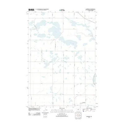
1973 Kampeska
Codington County, SD
2012 Grover
Codington County, SD
2012 Kampeska
Codington County, SD
2012 Kranzburg SW
Codington County, SD
2012 Pelican Lake
Codington County, SD
2012 Still Lake
Codington County, SD
2012 Still Lake SE
Codington County, SD
2012 Watertown East
Codington County, SD
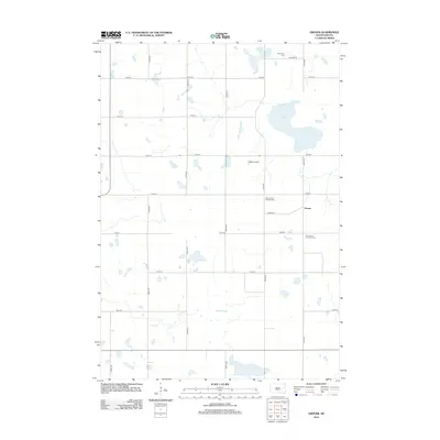
2012 Watertown SE
Codington County, SD
2012 Watertown West
Codington County, SD
2015 Grover
Codington County, SD
2015 Kampeska
Codington County, SD
2015 Kranzburg SW
Codington County, SD
2015 Pelican Lake
Codington County, SD
2015 Still Lake
Codington County, SD
2015 Still Lake SE
Codington County, SD
2015 Watertown East
Codington County, SD
2015 Watertown SE
Codington County, SD
2015 Watertown West
Codington County, SD
2017 Grover
Codington County, SD
2017 Kampeska
Codington County, SD
2017 Kranzburg SW
Codington County, SD
2017 Pelican Lake
Codington County, SD
2017 Still Lake
Codington County, SD
2017 Still Lake SE
Codington County, SD
2017 Watertown East
Codington County, SD
2017 Watertown SE
Codington County, SD
2017 Watertown West
Codington County, SD
2021 Grover
Codington County, SD
2021 Kampeska
Codington County, SD
2021 Kranzburg SW
Codington County, SD
2021 Pelican Lake
Codington County, SD
2021 Still Lake
Codington County, SD
2021 Still Lake SE
Codington County, SD
2021 Watertown East
Codington County, SD
2021 Watertown SE
Codington County, SD
2021 Watertown West
Codington County, SD
Featured Locations
- Sheridan Township, SD
- Watertown, SD
- Kranzburg South Township, SD
- Hamlin Township, SD
- Appleby, Sheridan Township