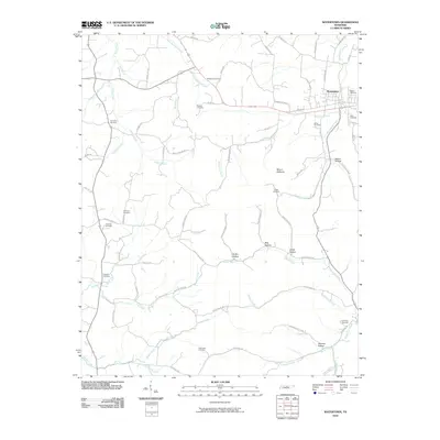
2010 Map of Watertown
USGS Topo · Published 2010About this map
Watertown serves as the primary hub of this Middle Tennessee landscape, where the confluence of Round Lick Creek and Beech Log Creek shaped the early development of the town's street grid. The map reveals a dense distribution of family burial grounds and community landmarks, such as Massey Cemetery and Thompson Cemetery, which provide essential clues for genealogical research in Wilson County.
Find a feature on this map
77 named features on this map. Tap any name to fly to it.
Don’t see what you’re looking for? This feature index may not catch every label — zoom into the map to look around manually.
Map Details
Editions of this 2010 Watertown Map
This is the sole edition of this map. No revisions or reprints were ever made.
Other maps of this area

1908 · Woodbury
USGS Topo · 1:62,500

1916 · Murfreesboro
USGS Topo · 1:62,500

1942 · Statesville
USGS Topo · 1:100,000

1942 · Lebanon
USGS Topo · 1:100,000

1951 · Lebanon
USGS Topo · 1:24,000

1956 · Vine
USGS Topo · 1:24,000

1956 · Columbia
USGS Topo · 1:250,000

1956 · Nashville
USGS Topo · 1:250,000
1957 · Lascassas
USGS Topo · 1:24,000

1958 · New Middleton
USGS Topo · 1:24,000