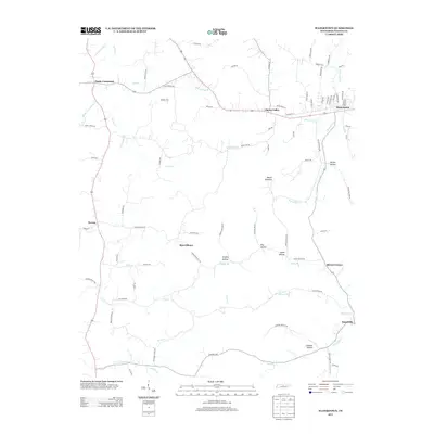
2013 Map of Watertown
USGS Topo · Published 2013About this map
Watertown and its surrounding rural communities are centered within a landscape of winding creeks and named hollows in Wilson County. The town site itself is a hub for local travel, where Tennessee Blvd and W Main St converge near the banks of Round Lick Cr. To the south and west, the map records a series of smaller historical settlements including Sherrilltown, Norene, and Statesville, reflecting the agricultural and residential patterns of this part of Middle Tennessee.
Find a feature on this map
89 named features on this map. Tap any name to fly to it.
Don’t see what you’re looking for? This feature index may not catch every label — zoom into the map to look around manually.
Map Details
Editions of this 2013 Watertown Map
This is the sole edition of this map. No revisions or reprints were ever made.
Other maps of this area

1908 · Woodbury
USGS Topo · 1:62,500

1916 · Murfreesboro
USGS Topo · 1:62,500

1942 · Statesville
USGS Topo · 1:100,000

1942 · Lebanon
USGS Topo · 1:100,000

1951 · Lebanon
USGS Topo · 1:24,000

1956 · Vine
USGS Topo · 1:24,000

1956 · Columbia
USGS Topo · 1:250,000

1956 · Nashville
USGS Topo · 1:250,000
1957 · Lascassas
USGS Topo · 1:24,000

1958 · New Middleton
USGS Topo · 1:24,000