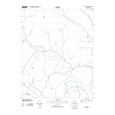
2010 Map of Waterview
USGS Topo · Published 2010About this map
Cumberland River sweeps through this section of southern Kentucky, anchoring a landscape defined by small rural hubs and historical river access points. Small settlements such as Waterview, Leslie, and Arat are linked by a network of winding county roads like Bull Ridge Rd and Dixie Hollow Rd, reflecting a traditional agricultural and residential pattern that persists into the early 21st century. The map highlights significant genealogical landmarks, including Branham Cemetery, Ellington Cemetery, and Newby Cemetery, which serve as quiet markers of the area's long-settled families.
Find a feature on this map
55 named features on this map. Tap any name to fly to it.
Don’t see what you’re looking for? This feature index may not catch every label — zoom into the map to look around manually.
Map Details
Editions of this 2010 Waterview Map
This is the sole edition of this map. No revisions or reprints were ever made.
Other maps of this area

1924 · Lillydale
USGS Topo · 1:62,500

1926 · Lillydale
USGS Topo · 1:62,500

1929 · Lillydale
USGS Topo · 1:62,500

1929 · Tompkinsville
USGS Topo · 1:62,500

1953 · Breeding
USGS Topo · 1:24,000

1953 · Waterview
USGS Topo · 1:24,000

1953 · Edmonton
USGS Topo · 1:24,000

1953 · Amandaville
USGS Topo · 1:24,000

1953 · Burkesville
USGS Topo · 1:24,000

1953 · Dubre
USGS Topo · 1:24,000