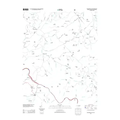
2013 Map of Waterville
USGS Topo · Published 2013About this map
Waterville and the settlement of Mount Sterling anchor the southern reaches of this mountainous landscape along the North Carolina and Tennessee border. The Pigeon River corridor near Browns and Waterville shows the concentrated development of this area, while the rest of the map is defined by a dense network of ridges and gaps. High-elevation interest is found at the Davenport Gap Appalachian Trail Shelter and Deep Gap Shelter, marking the path of long-distance hiking through this terrain. To the north, small communities like Raven Branch, Grassy Fork, and Tom Town are linked by winding roads such as Grassy Fork Rd and Big Orange Way. The map documents numerous family-named landmarks including Calder Ridge, Jake Ridge, and Strange Hollow, illustrating the deeply rooted human geography of these remote highlands just after the turn of the twenty-first century.
Find a feature on this map
169 named features on this map. Tap any name to fly to it.
Don’t see what you’re looking for? This feature index may not catch every label — zoom into the map to look around manually.
Map Details
Editions of this 2013 Waterville Map
This is the sole edition of this map. No revisions or reprints were ever made.
Other maps of this area

1893 · Mt Guyot
USGS Topo · 1:125,000

1894 · Asheville
USGS Topo · 1:125,000

1901 · Asheville
USGS Topo · 1:125,000

1912 · Mt Guyot
USGS Topo · 1:125,000

1935 · Newport
USGS Topo · 1:48,000

1935 · Hartford
USGS Topo · 1:24,000

1935 · Paint Rock
USGS Topo · 1:24,000

1935 · Neddy Mountain
USGS Topo · 1:24,000

1935 · Lemon Gap
USGS Topo · 1:24,000

1936 · Hepco
USGS Topo · 1:24,000