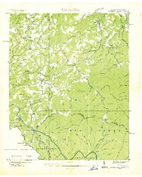
1936 Map of Waterville
USGS Topo · Published 1936About this map
Pigeon River and the Gatalooghee River converge at the heart of this mid-1930s survey, marking a landscape of significant industrial and conservation transition. The presence of a Power Plant, Surge Tank, and multiple segments of Mill Flume along Raven Fork suggest the area's role in early hydropower development, likely managed by the Tennessee Valley Authority. This industrial activity sits adjacent to the emerging Great Smoky Mountains National Park and the Cherokee National Forest, with the Appalachian Trail winding along the state line.
Find a feature on this map
66 named features on this map. Tap any name to fly to it.
Don’t see what you’re looking for? This feature index may not catch every label — zoom into the map to look around manually.
Map Details
Editions of this 1936 Waterville Map
This is the sole edition of this map. No revisions or reprints were ever made.
Other maps of this area

1893 · Mt Guyot
USGS Topo · 1:125,000

1894 · Asheville
USGS Topo · 1:125,000

1901 · Asheville
USGS Topo · 1:125,000

1912 · Mt Guyot
USGS Topo · 1:125,000

1935 · Newport
USGS Topo · 1:48,000

1935 · Hartford
USGS Topo · 1:24,000

1935 · Paint Rock
USGS Topo · 1:24,000

1935 · Neddy Mountain
USGS Topo · 1:24,000

1935 · Lemon Gap
USGS Topo · 1:24,000

1936 · Hepco
USGS Topo · 1:24,000