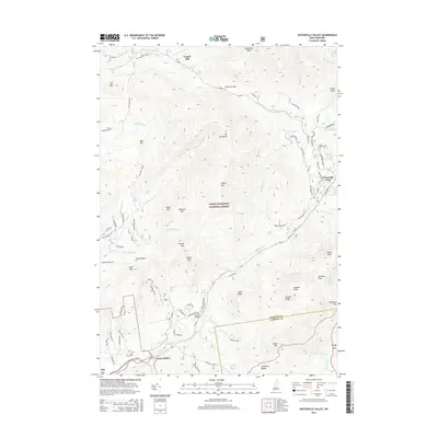
2015 Map of Waterville Valley
USGS Topo · Published 2015About this map
White Mountain National Forest dominates this landscape, where the Mad River carves through high peaks and narrow passes of the Sandwich Range. The settlement of Waterville Valley serves as a modern hub for the region, though the map preserves evidence of earlier industry and mountain life. In the north, Tripoli Mill stands near Thornton Gap, while the Mad River Cem and Goose Hollow mark the southern valley floor. The terrain is defined by dramatic elevations including Mt Tecumseh and Green Mtn, separated by features like Dickey Notch. A complex network of forest roads, such as Tripoli Rd and Sandwich Notch Rd, provides access to remote water bodies like Atwood Pond and Cone Pond. This survey details the boundary between Grafton Co and Carroll Co, illustrating how transportation routes like RT-49 follow the natural contours of the river valley.
Find a feature on this map
84 named features on this map. Tap any name to fly to it.
Don’t see what you’re looking for? This feature index may not catch every label — zoom into the map to look around manually.
Map Details
Editions of this 2015 Waterville Valley Map
This is the sole edition of this map. No revisions or reprints were ever made.
Other maps of this area

1895 · Crawford Notch
USGS Topo · 1:62,500

1896 · Crawford Notch
USGS Topo · 1:62,500

1928 · Plymouth
USGS Topo · 1:62,500

1929 · Franconia
USGS Topo · 1:62,500

1931 · Plymouth
USGS Topo · 1:62,500

1931 · Mt. Chocorua
USGS Topo · 1:62,500

1932 · Franconia
USGS Topo · 1:62,500

1946 · Crawford Notch
USGS Topo · 1:62,500

1949 · Portland
USGS Topo · 1:250,000
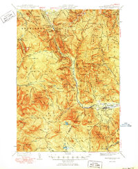
1950 · Crawford Notch
USGS Topo · 1:62,500