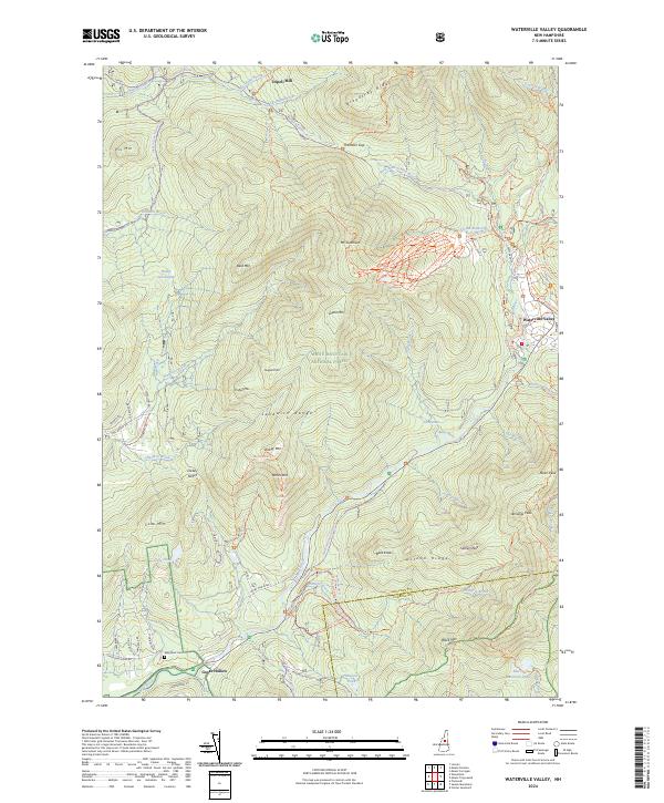
2024 Map of Waterville Valley
USGS Topo · Published 2024About this map
White Mountain National Forest dominates this landscape, encompassing a dense network of cross-country ski trails and rugged mountain peaks. The Sandwich Range and Acteon Ridge define the local topography, with Mt Tecumseh and Jennings Peak rising above the central valley. Settlement is concentrated along the Mad River, where the town of Waterville Valley serves as a hub for outdoor recreation, evidenced by an extensive system of winter trails including the Pipeline Trail XC Trl and Sno-Way XC Trl. To the south, the village of Goose Hollow sits near the Mad River Cem, providing a focal point for genealogical interest. Traces of historical industry and passage appear at Tripoli Mill and through the Sandwich Notch, where the Upper Mad River flows through a gap between the mountains.
Find a feature on this map
79 named features on this map. Tap any name to fly to it.
Don’t see what you’re looking for? This feature index may not catch every label — zoom into the map to look around manually.
Map Details
Editions of this 2024 Waterville Valley Map
This is the sole edition of this map. No revisions or reprints were ever made.
Other maps of this area

1895 · Crawford Notch
USGS Topo · 1:62,500

1896 · Crawford Notch
USGS Topo · 1:62,500

1928 · Plymouth
USGS Topo · 1:62,500

1929 · Franconia
USGS Topo · 1:62,500

1931 · Plymouth
USGS Topo · 1:62,500

1931 · Mt. Chocorua
USGS Topo · 1:62,500

1932 · Franconia
USGS Topo · 1:62,500

1946 · Crawford Notch
USGS Topo · 1:62,500

1949 · Portland
USGS Topo · 1:250,000
1950 · Crawford Notch
USGS Topo · 1:62,500