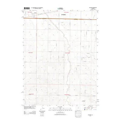
2013 Map of Watkins
USGS Topo · Published 2013About this map
Box Elder Creek meanders through the center of this landscape, cutting a north-south path across the high plains of the Adams and Arapahoe county line. In the north, the small settlement of Watkins sits at the junction of E Colfax Ave and several local thoroughfares, serving as a landmark on the edge of the expanding Aurora metropolitan area. The eastern portion of the sheet is defined by the ephemeral courses of Coal Creek and W Sand Cr, while the southern reaches contain the Running Creek Cem and the Harrington Ranch Airport. This territory reflects a phase of transition where large agricultural sections and open range meet a grid of developing rural roads such as E Quincy Ave and S Manila Rd.
Find a feature on this map
52 named features on this map. Tap any name to fly to it.
Don’t see what you’re looking for? This feature index may not catch every label — zoom into the map to look around manually.
Map Details
Editions of this 2013 Watkins Map
This is the sole edition of this map. No revisions or reprints were ever made.
Other maps of this area

1890 · East Denver
USGS Topo · 1:125,000

1939 · Coal Creek
USGS Topo · 1:24,000

1940 · Piney Creek
USGS Topo · 1:24,000

1942 · Box Elder School
USGS Topo · 1:31,680

1942 · Piney Creek
USGS Topo · 1:31,680

1942 · Coal Creek
USGS Topo · 1:31,680

1949 · Bennett
USGS Topo · 1:24,000

1951 · Manila
USGS Topo · 1:24,000

1953 · Denver
USGS Topo · 1:250,000

1954 · Watkins
USGS Topo · 1:24,000