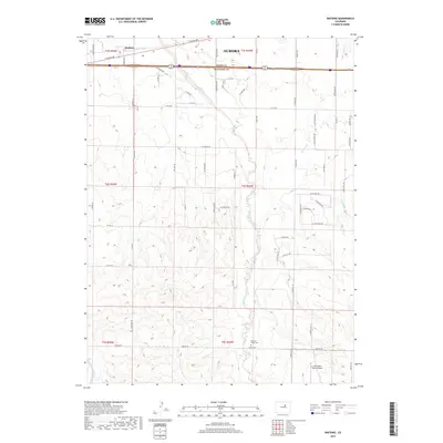
2019 Map of Watkins
USGS Topo · Published 2019About this map
The high plains of eastern Colorado meet the expanding urban reach of Aurora in this detailed survey, which spans the boundary of Adams and Arapahoe Counties. The settlement of Watkins serves as a primary reference point in the north, while the landscape further south remains largely defined by agricultural tracts and natural drainage systems. Significant watercourses including Box Elder Creek and Coal Creek meander through the terrain, illustrating the hydrologic character of the region. Local history and aviation interests are represented by the presence of the Running Creek Cemetery and the Harrington Ranch Airport, both situated in the more open southern sections of the quadrangle. A dense network of grid-based roads such as E Colfax Ave and S Watkins Rd reveals the systematic platting of the land as it transitions from rural homesteads to suburban development.
Find a feature on this map
65 named features on this map. Tap any name to fly to it.
Don’t see what you’re looking for? This feature index may not catch every label — zoom into the map to look around manually.
Map Details
Editions of this 2019 Watkins Map
This is the sole edition of this map. No revisions or reprints were ever made.
Other maps of this area

1890 · East Denver
USGS Topo · 1:125,000

1939 · Coal Creek
USGS Topo · 1:24,000

1940 · Piney Creek
USGS Topo · 1:24,000

1942 · Box Elder School
USGS Topo · 1:31,680

1942 · Piney Creek
USGS Topo · 1:31,680

1942 · Coal Creek
USGS Topo · 1:31,680

1949 · Bennett
USGS Topo · 1:24,000

1951 · Manila
USGS Topo · 1:24,000

1953 · Denver
USGS Topo · 1:250,000

1954 · Watkins
USGS Topo · 1:24,000