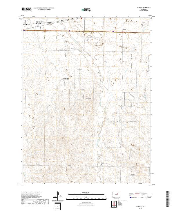
2022 Map of Watkins
USGS Topo · Published 2022About this map
Box Elder Creek meanders northward through this Colorado landscape, defining the topography of the high plains east of Denver. The settlement of Watkins sits at the intersection of a established grid system and major transit corridors, while the expanding footprint of Aurora is visible to the west. This 2022 survey captures the transition between rural ranching land and suburban development, with the Adams Co and Arapahoe Co line splitting the northern edge of the map. Evidence of the area's agricultural and local history is preserved at the Running Creek Cem and the Harrington Ranch Airport, which emphasize the long-standing land use patterns of the region. The map also traces the smaller drainage systems of W Sand Cr and Coal Creek, which cut through the open spaces between arterial roads like Manila Rd and Imboden Rd.
Find a feature on this map
66 named features on this map. Tap any name to fly to it.
Don’t see what you’re looking for? This feature index may not catch every label — zoom into the map to look around manually.
Map Details
Editions of this 2022 Watkins Map
This is the sole edition of this map. No revisions or reprints were ever made.
Other maps of this area

1890 · East Denver
USGS Topo · 1:125,000

1939 · Coal Creek
USGS Topo · 1:24,000

1940 · Piney Creek
USGS Topo · 1:24,000

1942 · Box Elder School
USGS Topo · 1:31,680

1942 · Piney Creek
USGS Topo · 1:31,680

1942 · Coal Creek
USGS Topo · 1:31,680

1949 · Bennett
USGS Topo · 1:24,000

1951 · Manila
USGS Topo · 1:24,000

1953 · Denver
USGS Topo · 1:250,000

1954 · Watkins
USGS Topo · 1:24,000